Tseng G, Kerner H, Nakalembe C, Becker-Reshef I. Annual and in-season mapping of cropland at field scale with sparse labels. Clim. Chang. AI. 2020:1-6.
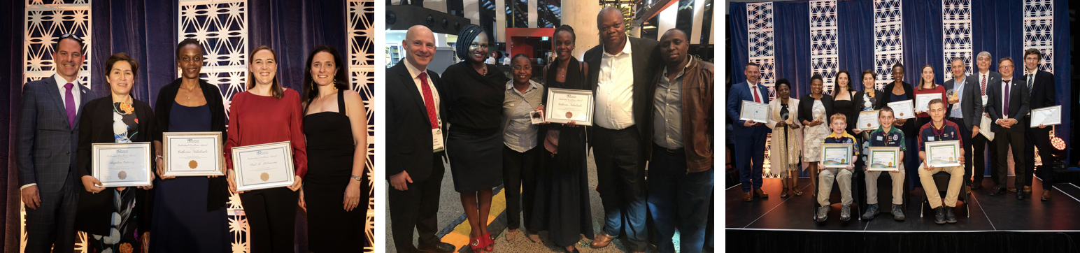
Recognition Along the Journey
2019
GEO Individual Excellence Award
2020
Africa Food Prize
2022
Uganda's Highest Civilian Medal
2022
AL-Sumait Prize
"These awards represent not just individual recognition, but acknowledgment of our entire SERVIR family's commitment to transforming agricultural monitoring in Africa."
Cambera 2019
College Park 2022
College Park 2022
College Park 2021
Geoglam Learning Exchange Kenya 2023
Learning Exchange Zambia 2024
Rwanda 2019
Learning Exchange Tanzania 2019
AST 3: EO-NAM West Africa
New Partnerships:
SERVIR West Africa Hub
Centre de Suivi Écologique (CSE) - Senegal
Lutheran World Relief - Mali
AGRHYMET Regional Center
Technical Goals:
Methods for Cropland Mapping
Methods for Crop-type Mapping
Crop Yield Modelling
Methods for Data collection
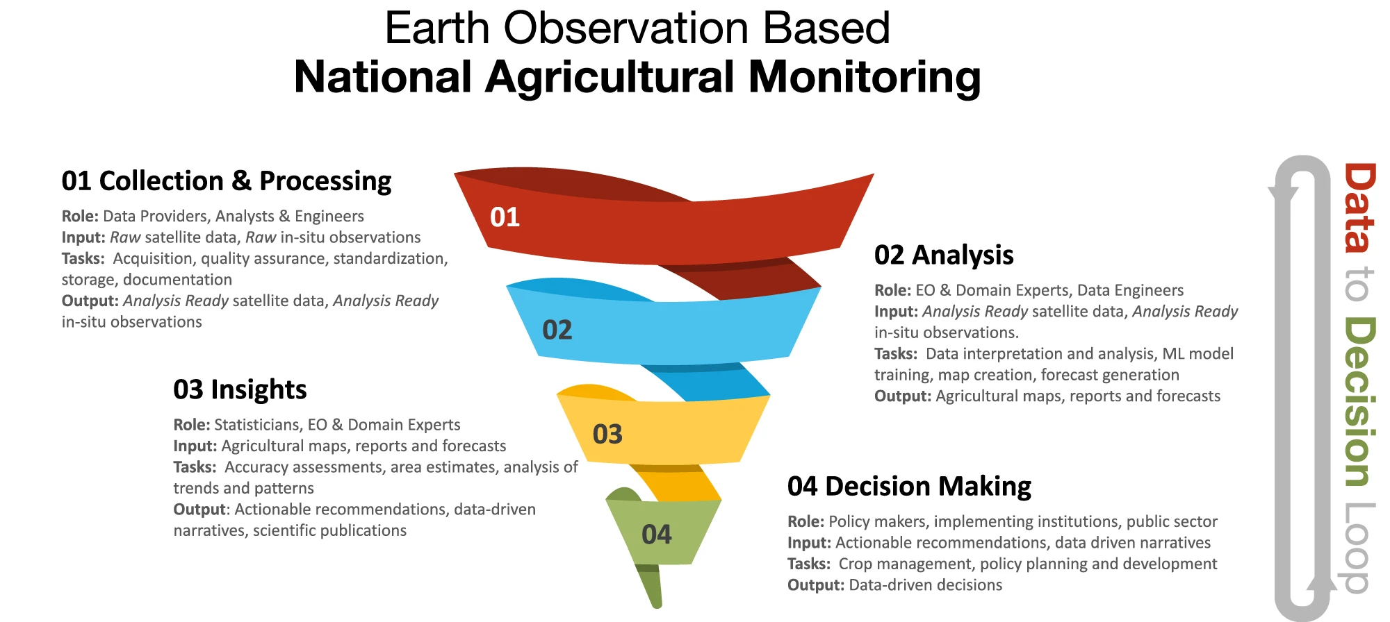
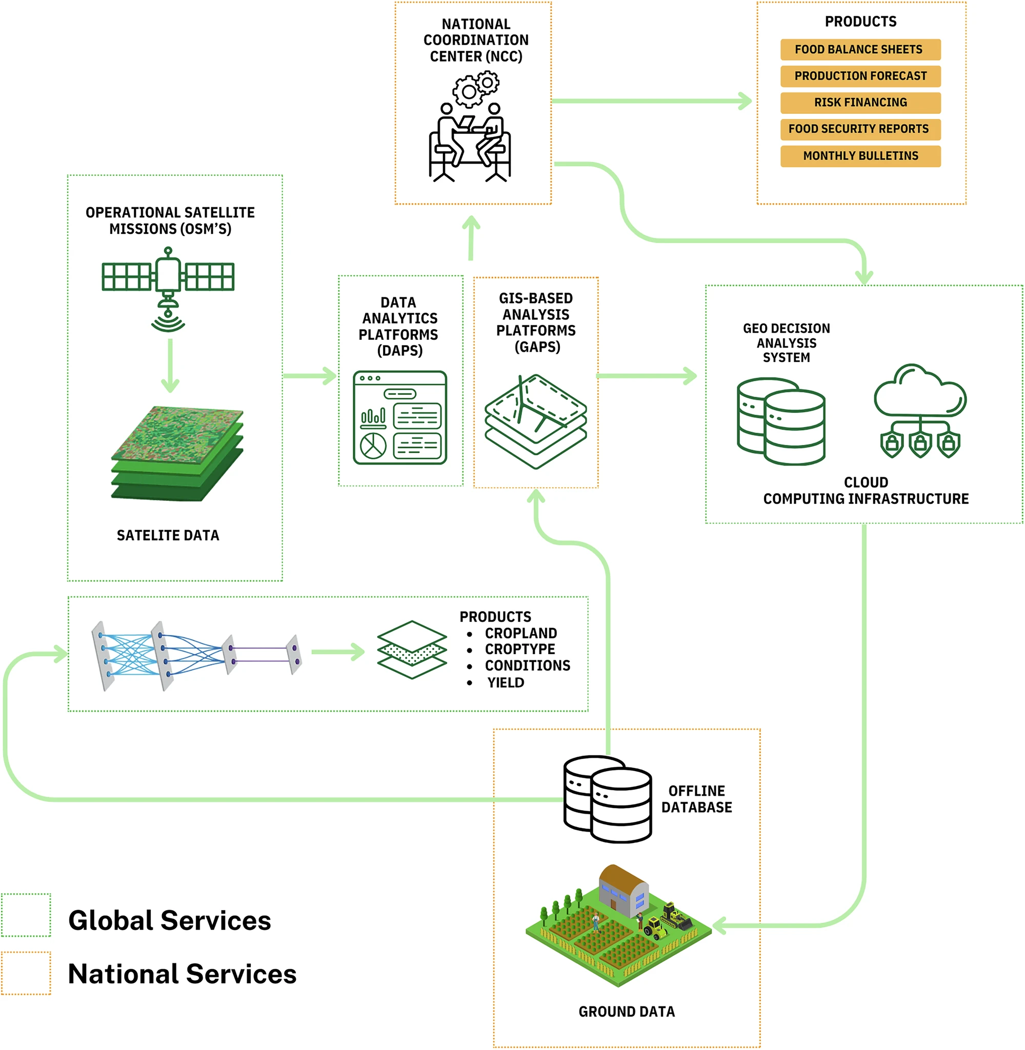
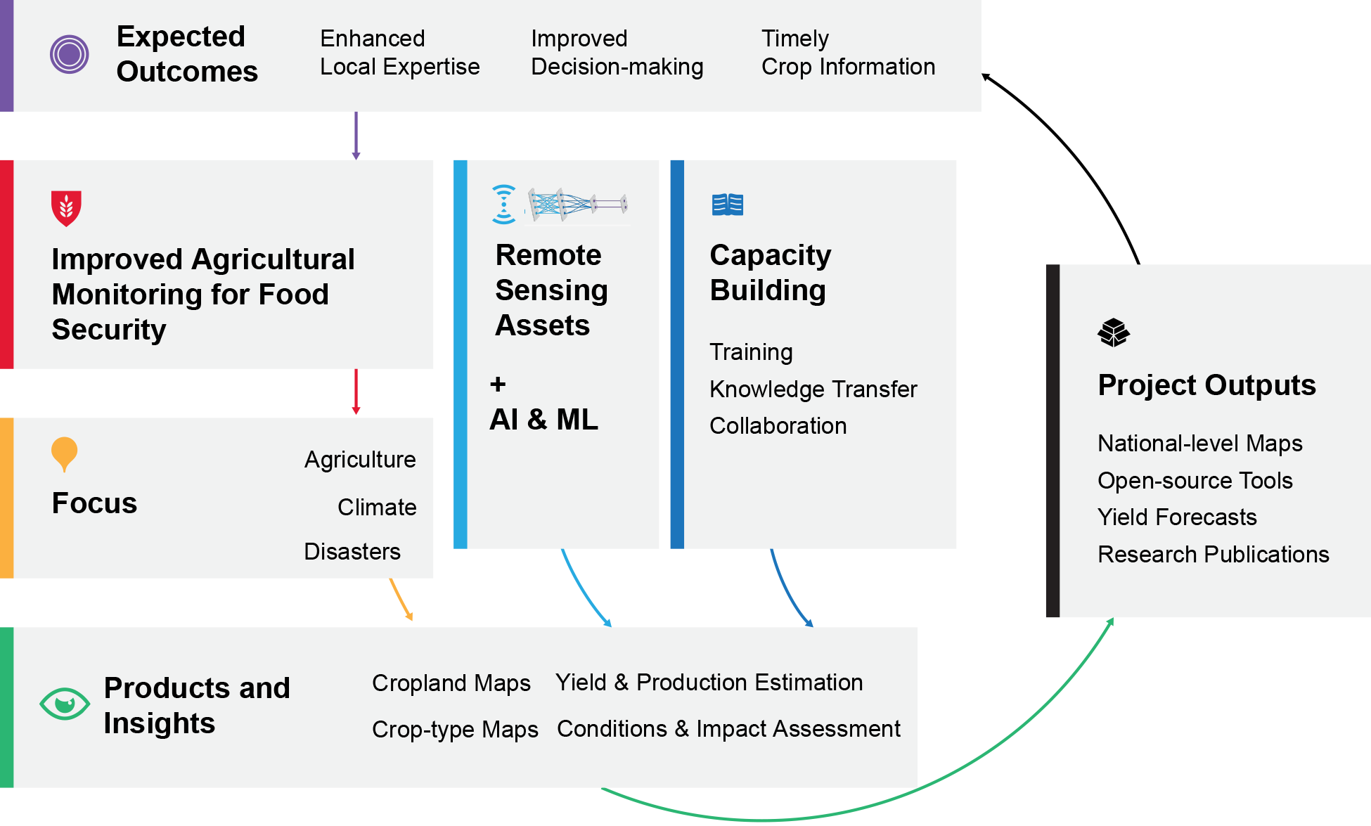
General architecture from satellite and ground data acquisition to decision making.
Satellite data from operational missions flows through data analytics platforms (DAPs) and GIS-based analysis platforms (GAPs) where machine learning generates agricultural products including crop classification, condition monitoring, and yield forecasting. The National Coordination Center (NCC) coordinates data integration while the Geo Decision Analysis System, supported by cloud computing infrastructure, delivers key outputs such as food balance sheets, production forecasts, and food security reports to support agricultural decision making at both national and global service levels.
Nakalembe, Catherine, Hannah R. Kerner, Ivan Zvonkov, Michael Humber, Antonio S. Galvez, Esther Makabe, Sara Venturini, and Inbal Becker-Reshef. "A framework for EO-based National Agricultural Monitoring (EO-NAM) for the African Context." npj Sustainable Agriculture 3, no. 1 (2025): 45.
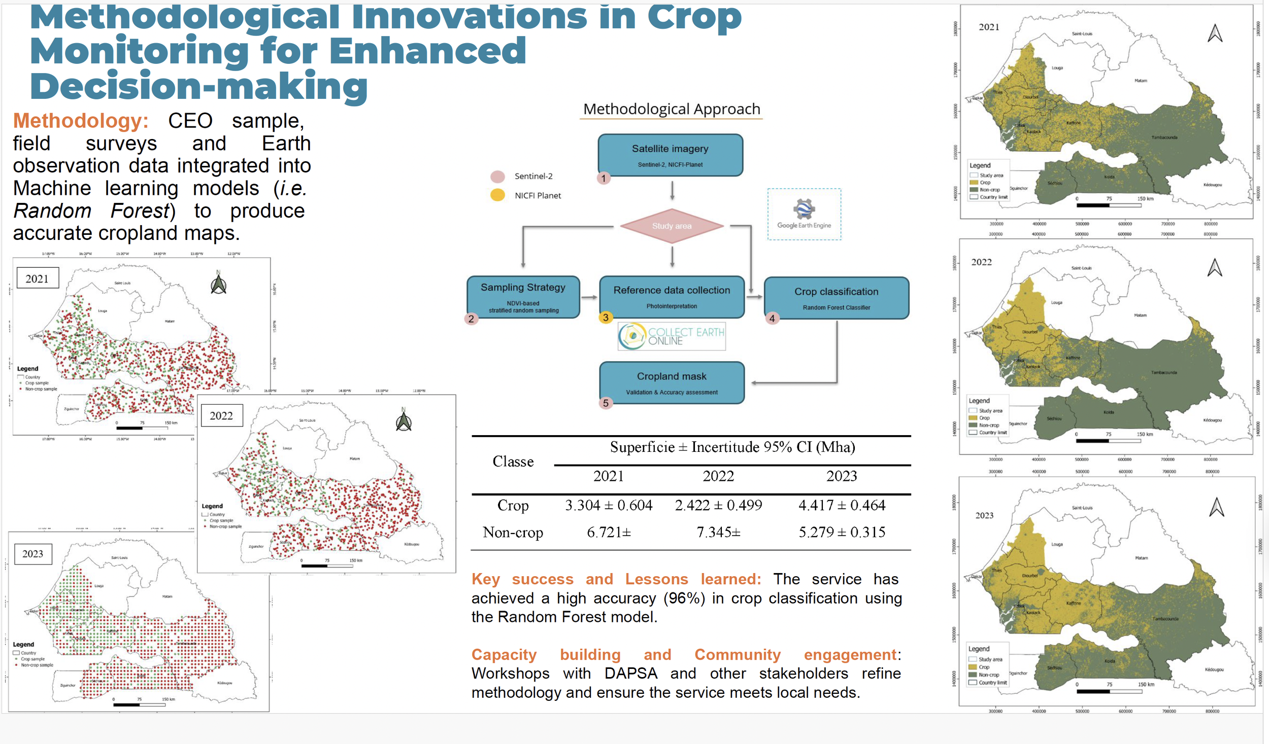
Methodologies in Action: Cropland Mapping with GEE
Scalable
Crop Classification Workflow
Easy to Deploy
Proven
Scalable Cropland Mapping with GEE
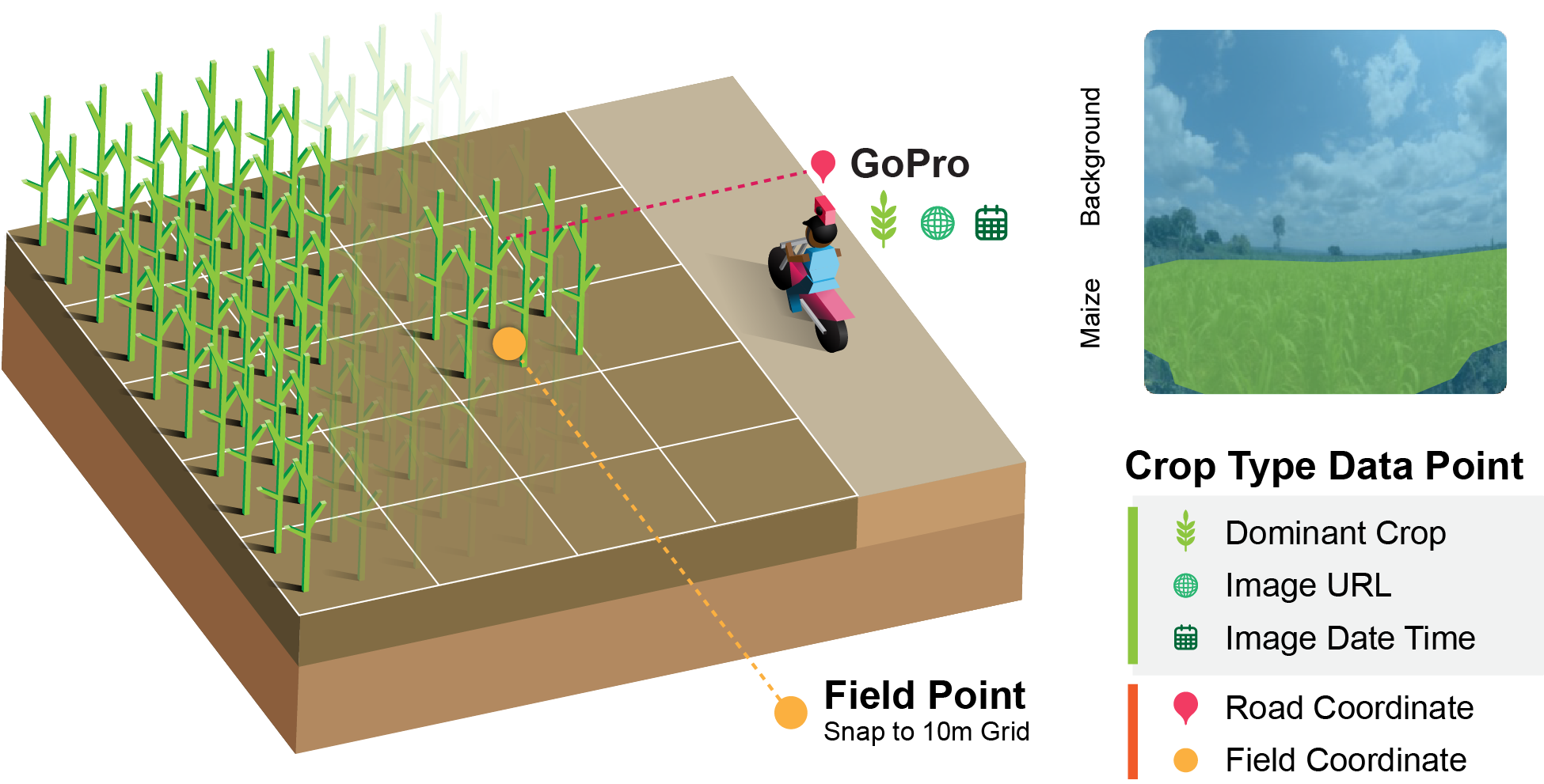
Methodologies in Action: Helmets Labeling Crops
Scalable
10+ countries
Easy to Deploy
Low Cost
Helemts Labeling Crops--> Nakalembe, C., Zvonkov, I., Kerner, H.R., Frimpong, D.B., Mwangi, K., Kioko, J., Tokas, B., Jawanjal, K., Smith, I., Paliyam, A. and Wakhanala, C., 2025. Helmets Labeling Crops: Kenya Crop Type Dataset Created via Helmet-Mounted Cameras and Deep Learning.
Methodologies in Action: InterComparison
Scalable
Plenty of Cropland Data to use
Tested
Collect Earth Enabled
Kerner, Hannah, Catherine Nakalembe, Adam Yang, Ivan Zvonkov, Ryan McWeeny, Gabriel Tseng, and Inbal Becker-Reshef. "How accurate are existing land cover maps for agriculture in Sub-Saharan Africa?." Scientific Data 11, no. 1 (2024): 486.
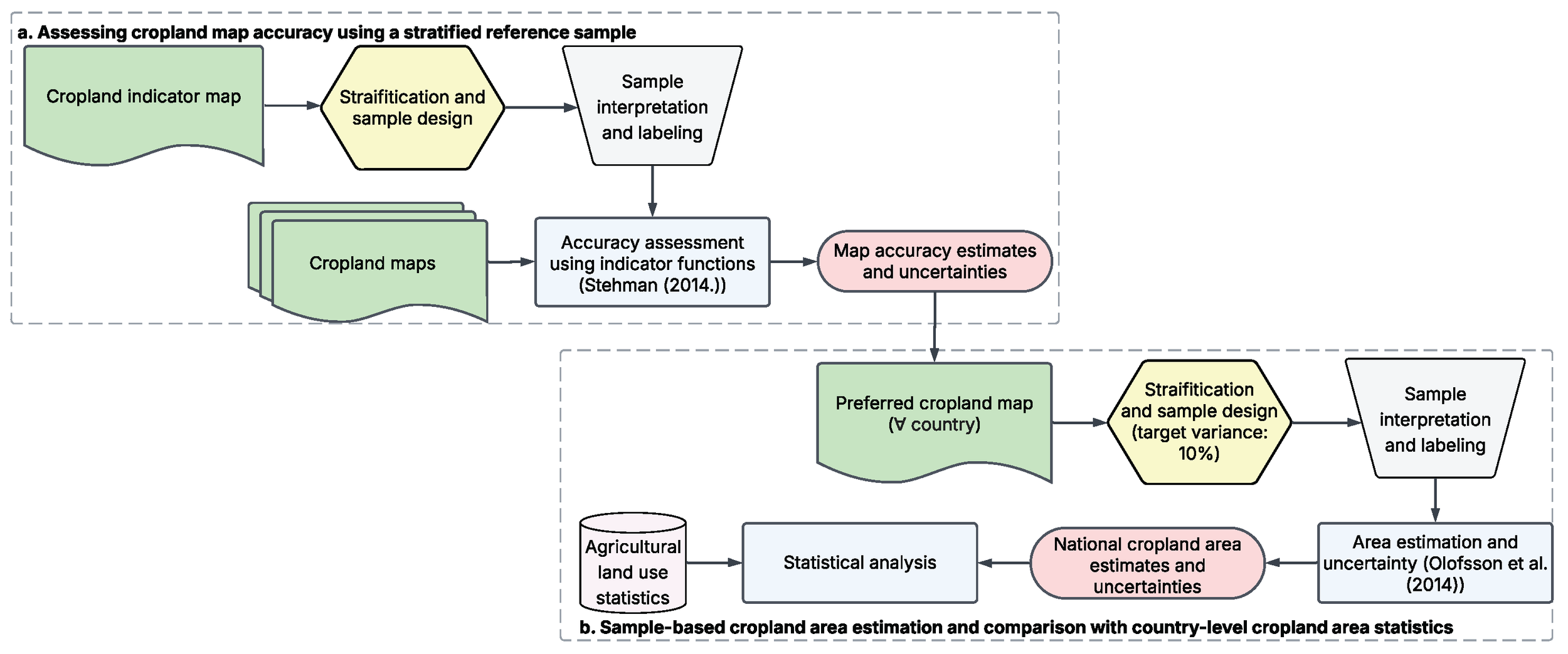
Methodologies in Action: Area Estimation
Scalable
Plenty of Cropland Data to use
Tested
Following Best Practices
Optimizing Satellite-Based Cropland Area Estimation
Through Integrated Map Accuracy Assessment and
Stratified Sampling Design Across Six African Countries
Methodologies in Action: Climate and Agricultural Production
Scalable
Great Learning Tool
<
Nakalembe, C., Frimpong, D. B., Kerner, H., & Sarr, M. A. (2025). A 40-year remote sensing analysis of spatiotemporal temperature and rainfall patterns in Senegal. Frontiers in Climate, 7, 1462626.
Technical Milestones & Innovations
Methods Tested and Deployed:
GEE Based-cropland classification workflow
Helmets Labeling Crops
Climate and Agriculture
Potential for Operational Systems:
Real-time crop condition monitoring
Early warning systems integration
Cadre Harmonisé regional support
Technology Readiness Level (TRL) Achievements
From Research to Operational Systems
3
4
5
6
7
Presented by Dr. Adama Sarr at SAGE 2024
GOAL TRL 6 - Systems operating in real environments with end-user adoption.
Publications & Scientific Impact
Selected Articles
Recent Publications (2024-2025):
Nature NPJ Sustainable Agriculture (2024): EO-NAM Framework for Africa
Nature Scientific Data (2025): Helmets Labeling Crops dataset
Frontiers in Climate (2024): 40-Year climate analysis in Senegal
IGARSS 2024: Field-scale yield estimation using remote sensing
AGU Perspectives 2024:Whose Priorities? EO Inequities Across Africa)
Nature Reviews Earth & Environment (2024): Global food production data scarcity
Nature Scientific Data (2024): How accurate are existing land cover maps for
Machine Learning & Methods (2020-2022):
IEEE CVPR (2021): Meta-learning for crop type prediction
NeurIPS (2021): CropHarvest global dataset
NeurIPS (2020): Annual cropland mapping with sparse labels
KDD Workshop (2020): Rapid response crop mapping
ArXiv (2020): k-NN classification for Kenya smallholder dataset
AAAI (2022): AI-EO for Agriculture in Sub-Saharan Africa
Global Applications & Reviews (2020-2021):
Global Food Security (2021): Satellite-based agricultural monitoring systems for Africa
Environmental Research Letters (2020): Urgent need for EO-based early warning systems
Remote Sensing of Environment (2020): GEOGLAM Crop Monitor for Early Warning
Frontiers in Sustainable Food Systems (2021): Enhancing EO access in E&SA through capacity building
Eos (2021): Sowing Seeds of Food Security in Africa
GEOGLAM Learning Exchange: Project-driven capacity building in Senegal
25+
Peer-reviewed Publications
10+
Conference Presentations
5+
Papers Under Review
Research Impact: From methodological innovations (CVPR, NeurIPS) to high-impact applications (Nature family) - spanning the complete research-to-operations pipeline across 9 years
SERVIR Impact
Partners
RCMRD (Kenya)
ICPAC (Kenya)
CSE (Senegal)
AGRHYMET (Niger)
Lutheran World Relief (Mali)
GEOGLAM (Global)
CIAT (Africa)
AGRA (Africa)
Countries Supported (Ministry)
Kenya (MOA)
Rwanda (MOA/ MET)
Senegal (DAPSA)
Uganda (OPM)
Ethiopia (MET)
Zambia (MOA)
Tanzania (MOA)
+Many more (Learning Exchanges)
Network Expansion: Across East, Southern, and West Africa
Capacity Building & Training
Building Local Expertise
200+
Professionals Trained
15+
Institutions Strengthened
6
Countries with Operational Systems
Training Programs:
CEO data collection workshops
Machine learning algorithm training
Yield model interpretation
Open source tool adoption
Sustainable Impact:
Local team self-reliance
Indigenous language tools
Continued system operation
Regional knowledge sharing
Real-World Impact
Transforming Decision-Making
Kenya Success Story: Operational Crop Monitor
Uganda Success Story: Disaster Risk Financing program - first operational use of EO for agricultural insurance in Africa
Early Warning Systems: Integrated into national food security protocols
Policy Support: Informing agricultural policy decisions across Africa
Philosophy: "Open access tools allow for customization to fit unique contexts without licensing barriers, enabling continued use beyond project lifetimes."
Open Resources Created:
OpenMapFlow workflow
CropHarvest dataset
CEO integration protocols
Training curricula
Methodology documentation
Sustainability Factors:
No licensing barriers
Customizable frameworks
Local capacity retention
Community-driven development
Institutional knowledge transfer
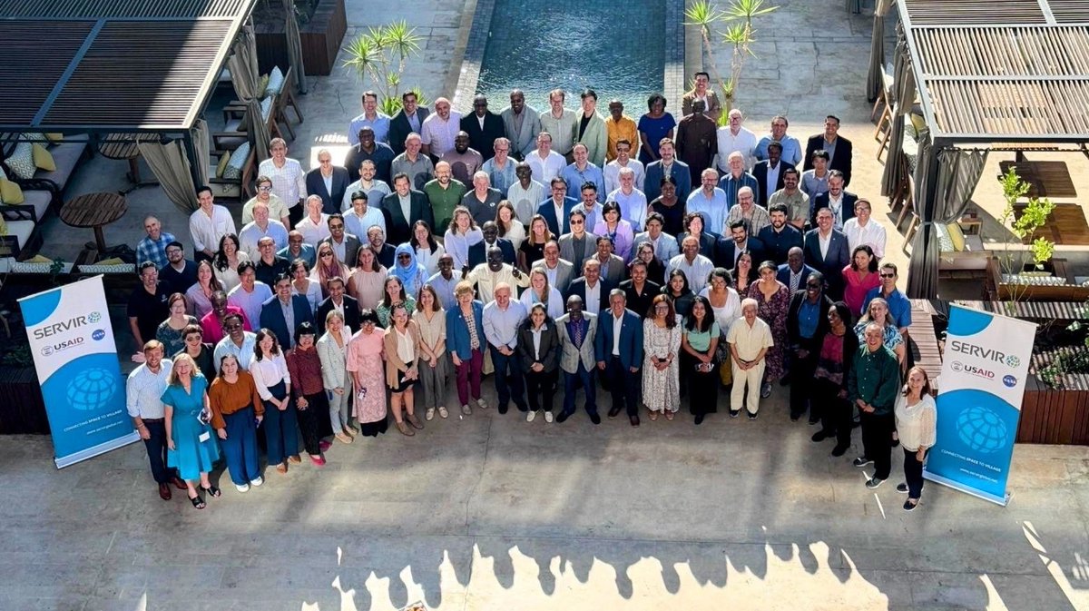
Part of the SERVIR Family
Nine Years of Collaboration
"Being part of the SERVIR family has been more than a professional journey—it's been about building lasting relationships, sharing knowledge, and working together toward a common vision of using Earth observation to improve lives."
What We've Built Together:
Trusted partnerships across three regions
Sustainable technical capabilities
A new generation of African EO experts
Operational systems serving millions
A model for international scientific collaboration
Legacy & Future
The Journey Continues
What We Leave Behind:
Operational crop monitoring systems
Trained teams across Africa
Open-source methodologies
Sustainable partnerships
A proven framework for success
What Continues:
Regional networks remain strong
Systems continue operating
Knowledge sharing persists
New collaborations emerge
Impact scales globally
"While this chapter with SERVIR concludes, the relationships we've built, the capabilities we've developed, and the impact we've created will continue to grow and inspire future innovations in agricultural monitoring."
Hopes and Dreams
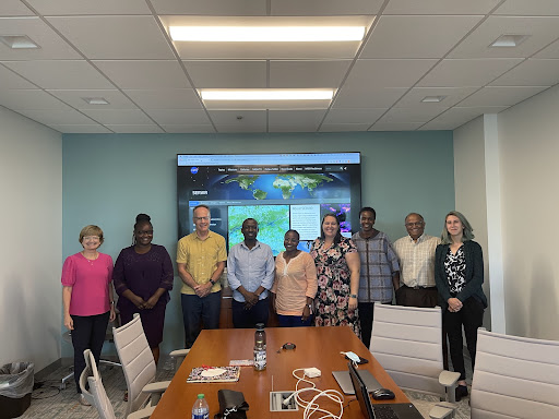
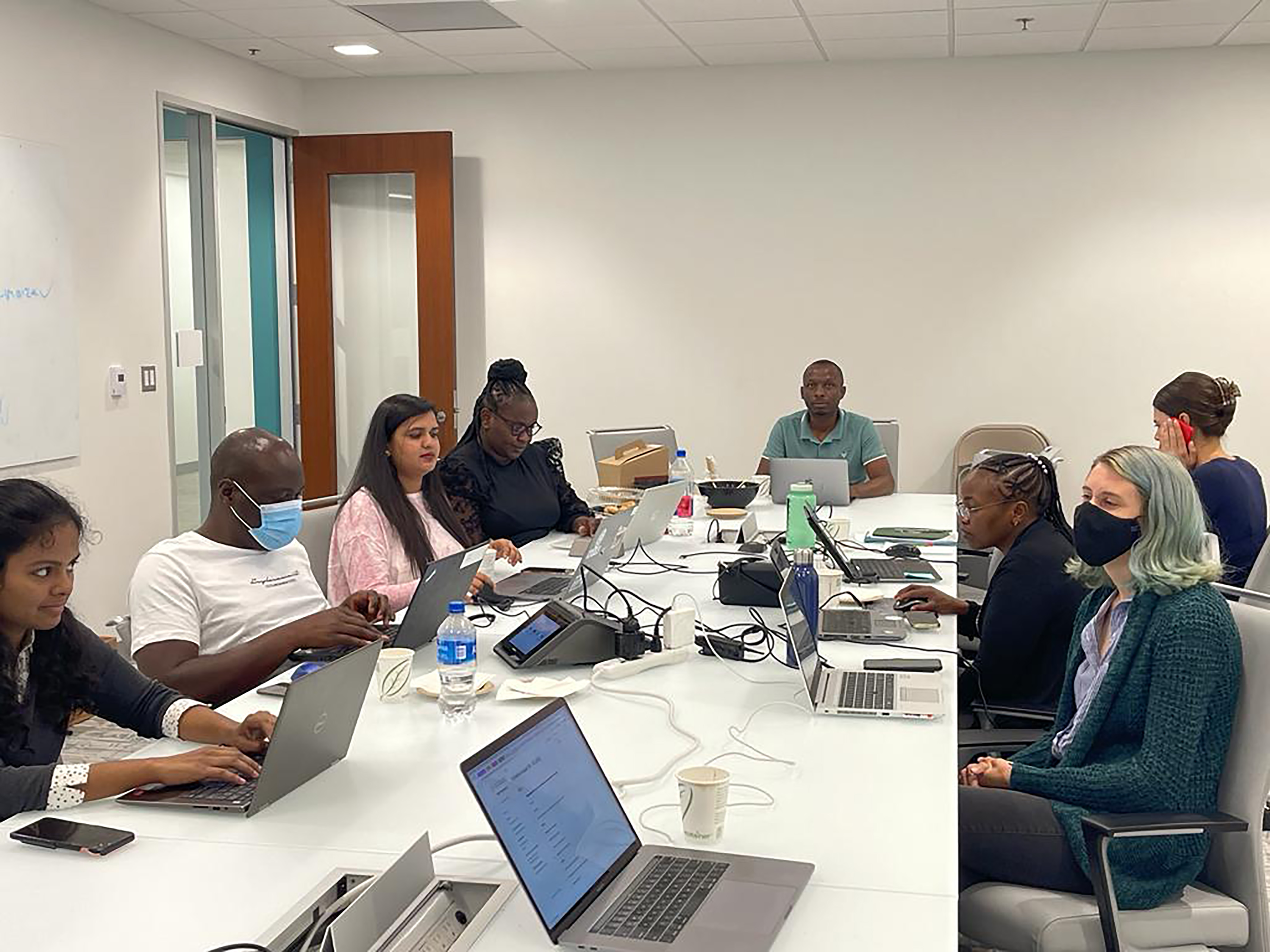
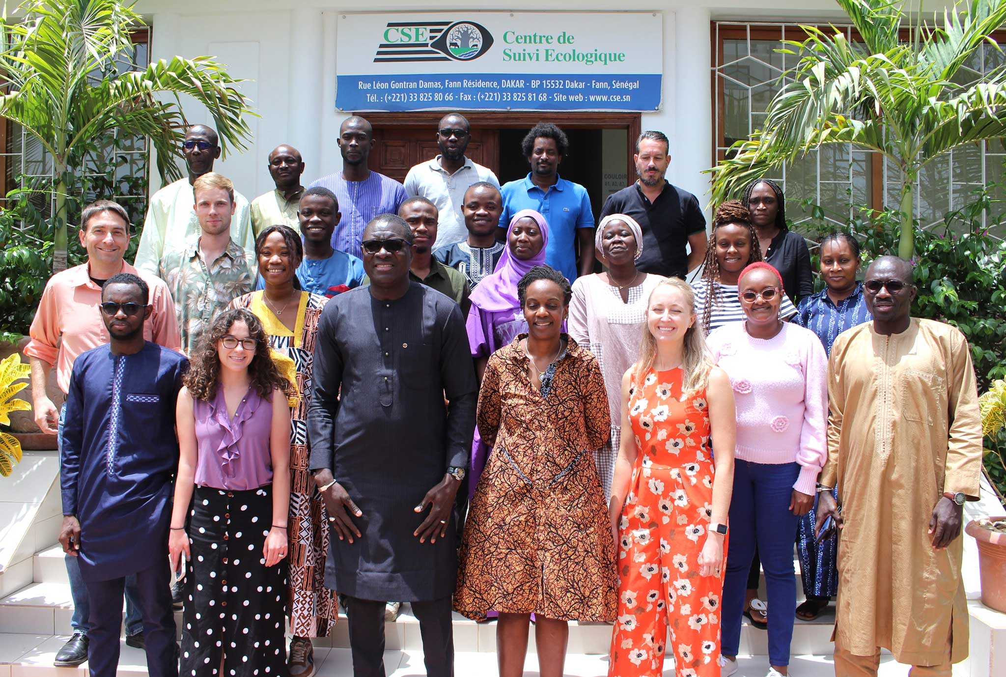
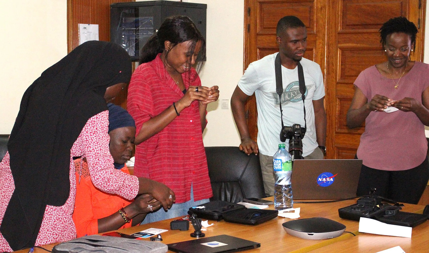
Training Memories: Senegal Partnership
Advanced Methods & Collaboration (2022-2025)
CSE
Primary Partner
DAPSA
Government Ministry
CEO
Training Sessions
Senegal Training 2024
Senegal Training 2024
Meeting at DAPSA 2024
Thank You, SERVIR Family!
9
Years of Partnership
3
African Regions
10+
Countries Impacted
∞
Lasting Friendships
"From Kenya to Senegal, from research to operations, from colleagues to family - thank you for an incredible journey. The seeds we've planted together will continue to grow and feed the world."